Prologue
In September Ben sent an email
asking if I'd like to hike the Milford Track in New Zealand. With a few milliseconds contemplation I
responded in the affirmative, although I had never heard of the place. Coincidentally, I was reading a book at
that time titled The Mitford Sisters, by Nancy Mitford, an odd
"slice of life" story about early 20th century English
eccentrics. I subsequently locked
in on the idea we were going to the Mitford Track evoking looks of sympathy and
pity from those more knowledgeable.
Eventually, I got it straight, and we collectively made the arrangements
to get to Queenstown, New Zealand, the launching point for the adventure. I was
a tad concerned about Ben getting out of NYC in the aftermath of Hurricane
Sandy, but it all worked out.
The Milford Track is a 33.9 mile
hike starting at the northern tip of Lake Te Anau, elevation 682', crossing the
3,750' elevation McKinnon Pass, and ending at the mouth of the Milford Sound
which opens into the Tasman Sea.
It is part of the 3-million acre Fjordland National Park located in the
southwestern corner of the south island of New Zealand.
Milford Track
November 2012
One should expect rain whilst
walking in a sub-alpine rain forest, but we've dodged the rain in other wet
locales and thought we might again, but not this time. It didn't just rain, it poured in
continual torrents during our first full day of hiking.
The setting is one of the
prettiest I've ever seen. Steep
canyon walls covered with dense, green vegetation rise from a narrow river
valley. We crossed a swinging bridge over the Clinton River and viewed a
swiftly flowing, crystal clear river with a slight tincture of Caribbean
blue. The river was about 100
yards wide and meandered within a lush valley about 500 yards wide, bracketed
by snow covered peaks and glaciers yielding their considerable waters down the
shear cliff walls into the valley.
The downpour turned out to be a
blessing by creating an abundance of waterfalls and water spouts. Ben and I observed several hundred
waterfalls over 300' during our first six hours of hiking with dozens in view
at any one glance. The rain
forest's canopy provided virtually no shelter from the relentless rain. Fortunately, we were well prepared and
wore satisfactory gear. Our
exertions kept us relatively warm.

For those who like the sounds and
sights of flowing water, the Milford Track must be the finest place on
earth. It was rare for there to be
a single moment when we weren't accompanied by the sound of flowing water,
ranging from a trickle to a torrent. There were times when the hiking path itself became a
5-6" deep rivulet. We were
advised to stay in the paths so as not to create new ones. Fortunately, both Ben and I had water
proofed, high-topped boots.
The Track is extremely well
maintained with hundreds of wooden bridges over every major water
crossing. However, in a downpour
new, un-bridged streams emerged quickly.
On one, we were able to make a dry crossing only by using stepping
stones that were submerged 5-6" deep under the surface of the 8-10' wide
stream. Other hikers told us of
slogging through it and getting wet up to their knees. We later learned one of our fellow
hikers took a full body plunge but quickly recovered.
We signed up with Ultimate Hikes
as part of an organized group. One
can also make arrangements through the NZ Department of Conservation and
proceed as one of the 40 per day permitted to embark as an independent hiker. We chose the more luxurious and
expensive option, primarily due to the logistics of getting to / from
Queenstown to the starting and ending points.
We met Thursday evening in
Queenstown at the Ultimate Hikes store for a pre-hike briefing and to pick up
the backpacks and bed sheets that they provide. We were presciently alerted by Marky, an energetic and edgy
29-year old and lead guide, "Plan on getting wet." On Friday morning we embarked in a
luxurious motor coach for the 4-5 hour journey to the hike's starting
point. A 120-mile drive took us
around the snaking, 52-mile long Lake Wakatipa and through beautiful
countryside featuring spring-green farms nestled at the base of snow covered
peaks. We learned that NZ is home
to 34 million sheep, 7-8 million cows, mostly dairy, and 1.5 million deer, for
both horns and meat, but only 4.3 million people. We lunched in Te Anau located on the western shore of the
eponymous lake and then rode further north to board a boat for the final leg of
the trip. Along the way we learned
that the breathtakingly beautiful but isolated lake features four inland
fjords, is 682' above sea level, and is over 1,200' deep.
On the boat ride up Lake Te Anau
we were told the following Maori myth about the creation of the fourteen fjords
in the park: "The favorite
son of a Maori god started carving fjords working his way from the southwestern
tip of the island northward. He
became more proficient with each of the first thirteen, but he achieved
perfection when he completed his final work with what would later become known
as Milford Sound. His sister
became jealous and responded by creating the annoying sand flies that are
attracted to the carbon monoxide exhaled by humans with the intent of
preventing man from ever viewing this beautiful sight." Fortuitously, her evil efforts were
subsequently thwarted by the timely invention of Off.
We disembarked at the northern
tip of the lake and were instructed to hike through pans of a soapy
disinfectant to insure that our boots weren't bringing unwanted plant life to
the pristine forest. We hiked 1/2
mile to Glade House, the first of the four lodges where we would stay. The independent hikers who shared our
Lake Te Anau boat ride hiked about 2 miles further upstream to their more
Spartan quarters.
The Glade House features a
spacious lodge and a series of rooms similar to a nice motel in the U.S. A group photo was taken of our group of
29 hikers and four guides, with whom we would be spending the next four
days. Ben and I were shown to our
four-person bunkroom and were fortunate to be the only occupants. This was the second week the Track had
been open for the season, and our group was not fully booked. We organized our packs and headed to
the dining area where tasty hors d'ouevres and drinks were being served. Their bar was well stocked with an
assortment of New Zealand wines and beers and even included Veuve Cliquot
champagne. No need to suffer minor
deprivations whilst hiking in the one of the most remote outposts on the
planet.
After dinner our guides showed us
slides of what to expect during the hike and made introductions. Our group consisted of 12 Australians,
9 Americans, and the remainder from England, Scotland, Wales, and
Singapore. The Scotsman, in his
self-introduction, concluded with the following: "...and I hope Scotland
remains forever part of the UK." A petite and attractive young lady
followed him and said without a molecule of humor, "I'm a physician. I live in England, but I'm Welsh. Don't ever call me English." Her husband, a hulk of a man, then
introduced himself, "I'm English. What can I say?" Afterwards, the
lovely wife of the Scotsman approached me and, presumably in response to my
mention of Kansas, said in a most pleasing brogue, "Do ya live in a
litt'ul 'ouse on the prairie?"
"Aye" said I.
I noted a sign in the lodge
"The only good stoat is a dead stoat" alerting hikers that there
would be traps along the trail for unwanted critters. Apparently, the stoat (aka short-tailed weasels or ermine),
and the equally pervasive, non-native nuisance, the Australian possum, have
wreaked havoc on the New Zealand bird population. The possums, first introduced in 1837 for their fur
producing potential, now number 70 million and have decimated the birds that
once inhabited the island. We
would see Kea, Weka, Blue Duck, and many other small and large birds we could
not identify, but sadly NZ is no longer a birder's paradise. Regretfully, we never spotted the
nocturnal Kiwi.
The generators were turned off at
10 pm and back on at 6:15 am serving as a useful alarm clock for those who
leave a light switch on. We awoke
and dined on a sumptuous English breakfast consisting of bacon, scrambled eggs,
cooked tomatoes, potatoes, toast, jam, and porridge. We prepared our lunches from the well-stocked table for that
purpose and prepared to embark. We
were instructed that we could refill our water bottle from any moving water,
thus lightening our packs.
We crossed the Clinton River on
the first of a dozen swinging bridges to begin our upstream journey. I quickly learned that it is much
easier to hike a swinging bridge alone.
Shared occupancy most often results in a stomach churning experience due
to non-harmonic walking.
The soil is only about 12"
deep throughout the region, but sufficient to support an abundance of
flora. At the lower elevations,
the moss, ferns, lichens, orchids, and undergrowth were dense. The Red Beech trees were as large as
the Douglas Fir one might find in Alaska and were host to an abundance of other
plant life. The granite walls surrounding the valley were also covered with
greenery, but we would occasionally spot a section stripped of all living
things, presumably the result of an avalanche or rockslide
At varying times the trail
consisted of sand, mud, interspersed tree roots, grass, pebbles, gravel, wooden
boardwalks, small rocks, and boulders.
It was common to see the shallow root structure of huge trees that had
fallen across the trail and later cut away. The path followed the swift flowing river that often
constricted into roaring cataracts.
We followed the north bank until we reached the north fork of the
Clinton at which time the canyon narrowed even further. Sheets of water roared
off the canyon walls. Waterfalls
exceeding 1,000' in height were commonplace, many sending chutes of water out
away from the rock.
The principal disadvantage of the
rain was the reduced visibility of the vistas. We also had the tendency to look down, not up, to avoid
drowning, and we used our cameras sparingly. After a few miles, we were comforted to learn that we were
not going to melt. The gradient
was gentle, we had only 10 miles to go on day one, and like children we reveled
in tromping through the rain-swollen paths and surging waterways. Ben and I most often hiked alone, as
everyone spread out along the trail.
We arrived cold, tired, and wet,
and were greeted by the staff of the Pompolona lodge (so named by Quintin
Mackinnon, the Scottish discoverer of the track and a veteran of the 1873
Prussian-Franco War, who once ran with the bulls in Spain). They provided a refreshing beverage and
showed us to our quarters. Even
though we had waterproof covers for our packs, I discovered about 1" of
water sloshing around in mine. Then we enjoyed the principal benefits of being
part of an organized tour. We took
hot showers, tended to the washing of some of our clothes, and, best of all,
placed our wet clothing into the "drying" room. We then ventured into the cozy lodge
and were welcomed with tea, scones, jam, and a roaring firebox heating the
spacious, carpeted lounge. A
partial glass ceiling and wall afforded grand views of the north canyon walls
and the snow capped peaks beyond.
We watched and listened to the pouring rain from these unexpectedly
luxurious surroundings.
We also enjoyed a newfound
bonhomie with our hiking companions.
We started the day mostly as strangers but now shared a new bond having
braved the relatively harsh weather.
Ben and I joined four hikers from Singapore; Keith, Alvin, John, and
Hwee. Mandarin was their second
language as they were of Chinese ancestry. Ben joined them in conversation in Mandarin, and John
exclaimed, "Pure! Your
Mandarin is excellent, and you speak with a pure tone, no accent. That's very rare for a non-native
speaker." They went on to
converse in Mandarin whilst I listened with no comprehension. During cocktails,
Alvin and Hwee treated us to a noteworthy piano concert.
We enjoyed exquisite dining,
venison medallions in my case, and getting acquainted with our tablemates. The
provisioning for each of the mountainside lodges came from helicopters. Over a
five-day period we had a chance to dine with everyone in our group, which was
conspicuous by the total absence of assholes. After dinner, the young guides, all in their 20's, briefed
us on what to expect the following day and set up a first aid station to tend
to minor blisters and injuries. We
retrieved our now dry and freshly hand laundered garments and trundled off for
an early bed-time and settled into our nice, but unheated, sleeping quarters.
The second day's hiking was the
most strenuous, covering 10 miles with a 3,000' ascent and 2,200' descent. We were off by 7:45 am and began in a
slight mist. As we ascended, the canyon and the river narrowed and the nature
of the vegetation changed. The
trees were smaller, the ferns and moss became less lush, and the path became
rockier. We left the river and
started hiking up a series of zigzags, aka switchbacks past the tree line at
2,950' where we gained views of dozens of snow and glacier covered peaks that
comprise a portion of the aptly named Southern Alps forming the nearly 500-mile
spine of New Zealand's south island.
The elevations of the peaks range from 6-12,000'. They are uncommonly jagged and majestic
and are located within tens of miles of the Tasman Sea. The final push to the pass was steep
and rocky, but I wasn't gasping for air.
At 3,200' the green vegetation
gave way to gorse and grasses reminiscent of the English Lake District. Small tarns dotted the landscape. We reached the highest point of the
Track, the Mackinnon Pass, and enjoyed our first up close encounter with the
Kea, the world's only alpine parrot.
We were warned to keep a close eye on our gear with Keas nearby, as the
critters love to tear into packs.
One half mile past the pass we stopped
for lunch and rest at a cabin conveniently built for hikers. As we were resting
and warming, several fellow hikers entered our shelter and reported hearing and
seeing avalanches in the distance.
We had crossed four avalanche zones earlier during the day, each
featuring warnings not to tarry. After lunch, we started our descent and heard
a series of loud cracks and explosions, but we never saw the slides as the snow
fields were obscured by clouds.
We crossed a large swinging
bridge over a cascading mountain steam, Moraine Creek, and proceeded to follow
it down for nearly 1,000'. A
series of manmade stairsteps and walkways, along with steep rock steps and
paths, enabled us to stay in the mist of the majestic chain of waterfalls.
We arrived tired, but not
exhausted, at our evening's destination around 4 pm. Once we were ensconced in the cozy, warm lodge, we
appreciated the late arrival of a heavy downpour. A scrabble contest was
organized, some worked on puzzles, and everyone enjoyed their refreshments and
shared stories from the day. I
visited with an Englishman and a San Franciscan, both of whom had recently
climbed Kilimanjaro. I listened attentively to their practical tips on
organizing and preparing for such a trip.
Team Singapore didn't arrive until 7 pm, two of their number having been
hobbled by knee and foot problems.
They were in surprisingly good humor and were greeted with cheers in
honor of their intrepidity.
We enjoyed muffins and tea,
cocktail hour, an exquisite dinner, a briefing about the final day's hiking,
and were off to bed. While
attending to nocturnal duties, I was thrilled to espy a crystal clear evening
and my first viewing of the southern sky.
We were at least 60 miles distant from the nearest light source,
heightening the brilliance of the stars.
The final day's hike was 13.9
miles with a 1,500' descent to the sea.
We ate our lumberjack breakfast, prepared our lunch, and started
off. The last third of the Milford
Track is one of the five rainiest places on earth averaging 8 meters
(315") rain per year.
Miraculously, we enjoyed one of their rare sunny days. By mid morning we had traveled about
4.5 miles, and I was down to hiking pants and an undershirt, and a pack
weighing around 30 lbs. We were back in the lush rain forest environment, but
it was slightly different. Palm
trees were now added to the wide variety of vegetation. We crossed nearly a dozen swinging
bridges over different streams, creeks, and rivers as we meandered our way down
to the sound.
Mile markers were placed along
the Track, and we took a certain amount of pleasure as we approached each. They enabled us to calibrate our
speed. On the first day, we
averaged 30-minute miles (2 mph), probably a little less on day two, but on day
three, we were rolling, averaging speeds of 2.5 mph including bursts over 3
mph.
With three full days of hiking
time together, Ben and I had ample time to contemplate matters of great
urgency. We were strolling along
mindlessly and out of the blue Ben's poses the following question: "What
went into the thinking when people decided that mannequins should have
nipples? Who's in charge of
that?"
But it didn't stop there.
Ben: "Does the number 1729
mean anything to you?"
Me: "No. Why do you ask two dogs?"
Ben: "It is the smallest
number expressible as the sum of two different pairs of integers cubed.
"
Me: "Who thinks of this
stuff?"
Ben: "9 and 10, and 12 and
1."
Me: "Way too cool."
Given the isolation of the
locale, a mid-trip injury or ailment would require a helicopter rescue,
resulting in unwanted opprobrium and expense. Upon reaching mile 31, I was feeling pretty confident I
would finish the journey unaided even if I had to crawl. I didn't give voice to this belief
knowing hubris predictably yields swift retribution. We were motoring along a well-groomed portion of the trail,
I had my head down lost in thought, and I hit my noggin on a large, low hanging
tree branch that dropped me to my knees.
Ben came quickly to my aid, fearing a knee injury, but his concern
quickly turned to pity when he realized it was only my head.
We lunched at the foot of the
500' Giants Gate Falls, skipped a few rocks into the mist, and marched on to
meet the 3:00 pm rendezvous with a boat charter at Sand Fly Point. We then hiked to a dock on the Arthur
River and got our first glimpse of the beautiful Milford Sound, proclaimed by
Rudyard Kipling as the 8th Wonder of the World. We were ferried to the tiny settlement of Milford and were
taken to the final lodging spot provided by Ultimate Hikes. The view from our room of Mitre Peak,
the sentinel of Milford sound, had to surpass James Hilton's envisioning of Shangri-La.

We enjoyed our final sumptuous
dinner and an awards ceremony documenting our successful completion of the
hike, and for no extra charge we were taken on a short stroll to see glowworms
in the nearby forest. We were
easily entertained.
After breakfast, we boarded a
touring boat for a closer look. We learned that sounds are carved by rivers and
fjords by glaciers, thus Milford Sound was created by two distinct glaciers,
the last moving at speeds of 8 meters per day. We enjoyed vistas of nearby
peaks and glaciers, sighted penguins and seals, ventured briefly to the Tasman
Sea, returned under a 450' waterfall, and returned for the 5-hour bus trip back
to Queenstown. The tour of Milford
Sound alone was worth the price of admission.
Ben summarized it best at the end
of day one, "This was the best hiking I've ever done." The guidebook refers to the Milford
Track as the "Holy Grail" of hiking. We now heartily concur.
Postscripts
The bus dropped us off at the
Ultimate Hikes store in downtown Queenstown about 3:30 pm Tuesday. Ben and I assembled our gear, bade
farewell to our new friends, and headed to our hotel. We stopped at the Moto Grill to satisfy a caffeine craving
and were greeted by the 30ish, tattooed barista. He apparently espied the logos on our packs and, in a
friendly manner, queried, "Just back from Milford? How was it?"
I replied, "It was one of
the coolest things I've ever done."
He said, "I'll take that as
a big positive coming from someone as old as you."
Ben arranged for us to have
dinner with Team Singapore on our final night in Queenstown. We gathered at an Italian restaurant
and relived our shared adventure.
We learned that Alvin distributes German pianos all around the world and
has traveled to the U.S. on 35 occasions.
John is an executive with Toshiba.
Keith is a Mayo trained cardiologist in private practice. Hwee is a merger & acquisition
specialist with the Singapore conglomerate that owns Adidas, explaining why all
four were dressed from head to toe in Adidas attire. The four have been friends
since young adulthood and have traveled the world together. They were delightful companions and
exemplify the spirit of joie d'vivre, qualities I admire greatly.
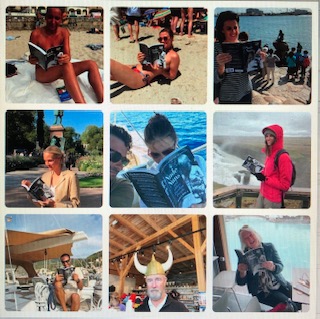
In keeping with my habit of
shameless huckstering, I told them of my desire to sell at least one copy of my
book, Nude Nuns and Other Peculiar People, while in New Zealand. Each of them graciously acquired a
copy, inaugurating my international sales campaign.
Moon, a young Korean and one of
our guides, learned that Ben and I intended to play golf in Queenstown the day
after our Milford trip. He
had the day off and graciously invited us to play with him at his club. He is a superb golfer and was a
pleasing companion to those of us who are not. Afterwards the cab driver that took us to the Queenstown
airport mentioned that he formerly drove the bus for Ultimate Hikes and made
over 500 trips from Milford to Queenstown. He said, "A rock slide blocked the road shortly after
you passed. You'd still be there
if you'd been a few hours later."
From Queenstown we flew to
Nelson, hiked in the Abel Tasman National Park, drove to Golden Bay, toured the
Marlboro Sound area and wrapped up our south island touring in Picton. We then caught the ferry to Wellington
on the southern tip of the north island.
On the ferry we encountered two fellow Milford hikers and arranged to
meet for dinner later that night.
We compared notes on our post-Milford travels and agreed that everything
we encountered in New Zealand was wonderful, but nothing matched the Milford
Track experience.
Ben and I drove from Wellington
to the middle of the north island and hiked the Tongariro Alpine Crossing, said
to be the best one-day hike in New Zealand. The 12-mile hike, two thirds of which was in snow and slush,
featured a 2,650' ascent and a 3,960' descent over the 6,000' shoulder of two
snow-capped volcanoes, Mt. Tongariro and Mt. Ngauruhoe, both lying in the
shadow of Mt. Ruepehu. It was a
beautiful and arduous hike, but radically different from Milford. We encountered hundreds of fellow
hikers, which was helpful in tramping down the snow. A few days earlier in Wellington I noticed the headline on
the back page of the local paper, "Ruapehu expected to erupt any
day." The bus driver taking
us to the hike's starting point told us the same thing. He also mentioned that one of the two
huts on the trail was hit by a flying boulder about the size of an automobile a
few weeks ago, presumably launched from the earth's bowels. He added,
unnecessarily I might add, "If you see one coming, duck."
Fortunately, we were neither incinerated nor squished by volcanically launched
missiles.

While in New Zealand for 16 days,
we flew 1,500 miles, drove our rental car 1,000 miles, hiked 100 miles, and
partook of other conveyances including buses, ferries, and cabs. We barely scratched the surface of this
large and beautiful land, but we relished seeing the farms, ranches, vineyards,
forests, hobbit homes, and countryside of all manner, big and small towns, and
uncommonly pleasant and helpful citizens. What a place!
Miscellany
Pine trees grow in NZ at three
times the rate they grow in North America.
Four of the 29 hikers in our
group had work origins with Arthur Andersen.
The hardest part about driving on
the "wrong side" of the road is parallel parking.
Yes, the drains do whirl
backwards (clockwise).
We saw nothing remotely
resembling unsightliness.
Gasoline is $8/gallon.
After returning to the US, we
received an invitation from Team Singapore to join them on the Nakasenda Walk
in Japan in 2013.
In the event you've an interest
in photos from the trip, click on the addresses below to access my Shutterfly
account. You'll note that it is
organized into three albums:
Milford, Tongariro, and New Zealand miscellany.
When you go to this site you
should arrive at the Milford Track album.
Click on "slideshow" to view this album. Click on "Back to albums" to
see the other two albums.
No comments:
Post a Comment